Florian Lautenschlager, M.Sc.

Chair of Data Science (Informatik X)
University of Würzburg
Am Hubland
97074 Würzburg
Germany
Email: Lautenschlager@informatik.uni-wuerzburg.de
Phone: (+49 931) 31 - 86489
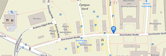
Office: Room B103 (Computer Science Building M2)
Projects and Interests
In the project P2Map I am trying to combine objective sensor data with subjective context information and to use this combined information in machine learning methods to predict a geospatial and temporal distribution of air quality.
Therefore my interests spread across data mining and machine learning methods in general and more specificly methods for spatiotemporal data, for example land use regression. I am trying to develop a more general approach, because most land use regression models are designed for certain regions and rely on land usage data that may be only available in this region. For this task, neural networks, especially convolutional neural networks, are tested at the moment.
In another facet of the P2Map-project, an array of low cost sensors has to be calibrated in order to reliably measure the surrounding air quality. Finally for the incorporation of the subjective data, like context information or perceptions, I will be working with techniques from the field of natural language processing.
Teaching
Introductions to algorithms and data structures:
Seminar "Web 2.0":
Seminar "Machine Learning":
Publications
-
 OpenLUR: Off-the-shelf air pollution modeling with open features and machine learning. . In Atmospheric Environment, 233, bl 117535. 2020.
 -
 MapLUR: Exploring a New Paradigm for Estimating Air Pollution Using Deep Learning on Map Images. . In ACM Trans. Spatial Algorithms Syst., 6(3). Association for Computing Machinery, New York, NY, USA, 2020.
 -
 Anomaly Detection in Beehives using Deep Recurrent Autoencoders. . In Proceedings of the 9th International Conference on Sensor Networks (SENSORNETS 2020), bll 142–149. SCITEPRESS – Science and Technology Publications, Lda., 2020.
- [ BibTeX ]
-
 SimLoss: Class Similarities in Cross Entropy. . 2020.
 -
 EveryAware Gears: A Tool to visualize and analyze all types of Citizen Science Data. . In Proceedings of VGI Geovisual Analytics Workshop, colocated with BDVA 2018, D. Burghardt, S. Chen, G. Andrienko, N. Andrienko, R. Purves, A. Diehl (reds.). KOPS, 2018.
- [ BibTeX ]
-
 Air Trails--Urban Air Quality Campaign Exploration Patterns. . In AGILE Workshop. 2018.
- [ BibTeX ]

